
Positioning, Obstacle Sensing and Service Applications
RAISE GENIUS · PARENTS & SCHOOLS
Positioning, Obstacle Sensing and Service Applications
Technology supporting transport work is the archive’s topic. It introduces navigation, obstacle sensors and applications through familiar passenger and delivery tasks.
Contact the teamOn this page
Technology supporting transport work: positioning and maps
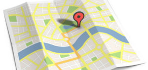
The first example is GPS. A receiver uses signals broadcast by satellites to calculate position and time. Ordinary GPS reception is one-way; the vehicle does not have to send a message back to a GPS satellite.
A separate map and routing service can suggest a journey. A fleet device may also send location or speed information through another communication link. The archive’s discussion of speed monitoring should not imply GPS itself automatically slows a vehicle or issues a penalty.
Obstacle sensors and their limits
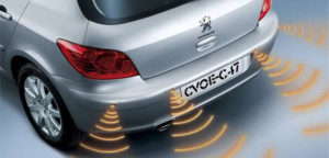
The second example is detecting an object near a vehicle, with ultrasound and infrared among the sensor types named. A system may warn a driver or contribute to a particular automated function.
Detection has limits and depends on the equipment, target and environment. An educational robot avoiding an object is not proof that a road vehicle can drive safely without a responsible operator. Driving and delivery work also involve real hazards, despite the source’s light-hearted introduction.
Applications connect a request with a service
The third example is software used to request passenger travel, a parcel delivery or food. GrabBike, Uber and LINE MAN appear as examples in the historical source.
Names do not establish that every service operates in the same place today. The article’s broad claim that applications originated only in military decoding is not a complete history of software and is not repeated as fact.
Compare the purpose and the information used
Ask which part locates the vehicle, which part interprets an obstacle and which part connects a customer with a service. These functions can work together but are not interchangeable.
Technology supporting transport work offers a useful model-design conversation. Check actual service availability and conditions directly; this archive does not recommend a provider or replace road-safety instructions.
Original photographs and artwork
These images are retained from the original page as examples of published learning activities and programme information. Some contain Thai text or historical dates. They do not guarantee the same result for a new learner. Confirm current programmes with the team.
View original images
Frequently asked questions
Does an ordinary GPS receiver transmit to the satellites?
No. It receives their broadcast signals.
Does GPS itself enforce vehicle speed?
No. Fleet reporting or control requires additional systems.
Are the app names a current service directory?
No. They are historical examples.
Contact and related pages
Tell the team about the learner or organisation, relevant experience and the intended learning purpose. Confirm the current programme, equipment, availability, schedule and fees before booking.
Contact Raise Genius School service overview
- Curved Motion, Contact Forces and Engineered Restraints
- Observations, Computer Models and Communicating the Result
- Observation Tools and a Necessary Product Safety Correction
- The Thames Barrier, Boxwall and FloodBreak
- Chemistry, Fingerprint Traces and Reconstructing a Scene
- Infrared, Radio and the Actual Classroom Equipment
- Materials, Propulsion, Navigation and a Historical Correction
- Ideas, Gliders, Control and Building on Earlier Work
- Movement, Mission Tools and the Operating Environment
Course-selection guide · Robotics portfolio projects · Competition preparation · Team advice and coaching · Course guide · General FAQ
Related services: School robotics camps · STEM activity stations
Related learning: Raise Maker Arduino · micro:bit robotics · IOTBot & AI · Portfolio preparation · Camp proposal · Accompanying teachers
Related reference: GPS.gov: space segment and broadcast signals
